Today’s population health challenges are complex. Addressing these challenges and building environments that value and promote health for everyone requires expertise from multiple scientific disciplines and public and private partners.
Guided by the principles of scientific rigor, equity, justice, community engagement, and multidisciplinary and multi-institution collaboration, the Lerner Center’s mission is to improve population and community health through research, education, outreach and health promotion programming focused on the social, spatial and structural determinants of physical, mental and behavioral health and health disparities.
With faculty affiliates from public health, sociology, psychology, economics, medicine and public administration, the Lerner Center’s approach to research is both multidisciplinary and interdisciplinary.

Established in 2011 with an endowment from Sid and Helaine Lerner, the center fulfills its mission through the interrelated pillars of research, education, advocacy and action.
Mapping Latin America: A Cartographic Reader
Edited by Jordana Dym, Karl Offen
University of Chicago Press, January 2011
For many, a map is nothing more than a tool used to determine the location or distribution of something—a country, a city, or a natural resource. But maps reveal much more: to really read a map means to examine what it shows and what it doesn’t, and to ask who made it, why, and for whom. The contributors to this new volume ask these sorts of questions about maps of Latin America, and in doing so illuminate the ways cartography has helped to shape this region from the Rio Grande to Patagonia.
In Mapping Latin America, Jordana Dym and Karl Offen bring together scholars from a wide range of disciplines to examine and interpret more than five centuries of Latin American maps. Individual chapters take on maps of every size and scale and from a wide variety of mapmakers—from the hand-drawn maps of Native Americans, to those by famed explorers such as Alexander von Humboldt, to those produced in today’s newspapers and magazines for the general public. The maps collected here, and the interpretations that accompany them, provide an excellent source to help readers better understand how Latin American countries, regions, provinces, and municipalities came to be defined, measured, organized, occupied, settled, disputed, and understood—that is, how they came to have specific meanings to specific people at specific moments in time.
The first book to deal with the broad sweep of mapping activities across Latin America, this lavishly illustrated volume will be required reading for students and scholars of geography and Latin American history, and anyone interested in understanding the significance of maps in human cultures and societies.
Related News
School News

Dec 5, 2022

School News

Feb 17, 2022
Commentary

Sep 27, 2021
Population Health Brief Series
Research Projects
Research by Lerner affiliates is regularly funded by the National Institutes of Health, Robert Wood Johnson Foundation, Russell Sage Foundation and many other federal agencies and foundations. The Lerner Center also funds population health research at Syracuse University through its Faculty Fellows Program.


Student Opportunities
Are you an undergraduate or graduate student at Syracuse University interested in population and community health? Do you seek a career with meaning and purpose?
The Lerner Center provides distinctive experience that combines traditional and applied training in population health and community health research and engagement to address pressing local, regional and national health problems and reduce health inequities—from academic certificates, to internships, to service learning opportunities and more.
Healthy Monday
Learn tips and tricks to jump start your Monday, maintain or promote healthy behaviors and help to end preventable chronic diseases.

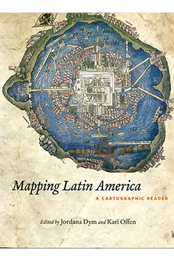
Mapping Latin America: A Cartographic Reader
Edited by Jordana Dym, Karl Offen
University of Chicago Press, January 2011
For many, a map is nothing more than a tool used to determine the location or distribution of something—a country, a city, or a natural resource. But maps reveal much more: to really read a map means to examine what it shows and what it doesn’t, and to ask who made it, why, and for whom. The contributors to this new volume ask these sorts of questions about maps of Latin America, and in doing so illuminate the ways cartography has helped to shape this region from the Rio Grande to Patagonia.
In Mapping Latin America, Jordana Dym and Karl Offen bring together scholars from a wide range of disciplines to examine and interpret more than five centuries of Latin American maps. Individual chapters take on maps of every size and scale and from a wide variety of mapmakers—from the hand-drawn maps of Native Americans, to those by famed explorers such as Alexander von Humboldt, to those produced in today’s newspapers and magazines for the general public. The maps collected here, and the interpretations that accompany them, provide an excellent source to help readers better understand how Latin American countries, regions, provinces, and municipalities came to be defined, measured, organized, occupied, settled, disputed, and understood—that is, how they came to have specific meanings to specific people at specific moments in time.
The first book to deal with the broad sweep of mapping activities across Latin America, this lavishly illustrated volume will be required reading for students and scholars of geography and Latin American history, and anyone interested in understanding the significance of maps in human cultures and societies.
Related News
School News
Dec 5, 2022
School News
Feb 17, 2022
Commentary
Sep 27, 2021